On June 24 and 25, 2017, Jenny and I and our friend Vicki climbed Mount Rainier [1].
Jenny and I drove out on Friday afternoon and picked up our wilderness camping permit for Camp Muir. We had dinner at the Paradise visitor center (a first for me), and then drove down to Cougar Rock campground to sleep. We drank half a gallon of water, peed like crazy, but got about 7.5 hours sleep in and felt very hydrated in the morning.
 [2]
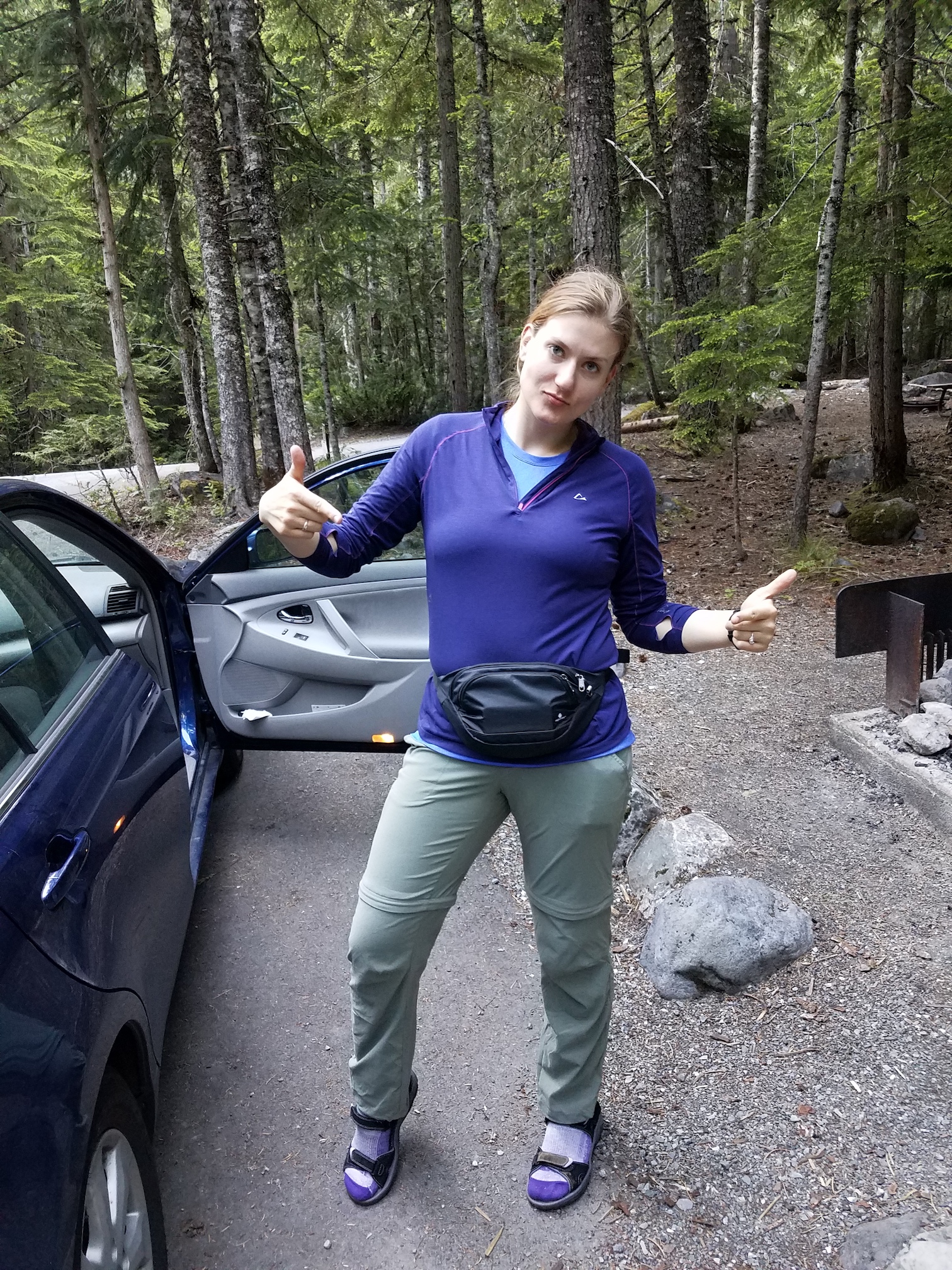
[2]Jenny at our camp site on Friday, excited about her fanny pack.
At 4 AM, we packed up our tent and drove back to Paradise. Once there, we finished packing our backpacks and waited for Vicki to arrive, who was on time. At 6:30, we started hiking up towards Camp Muir, just as planned.
 [3]
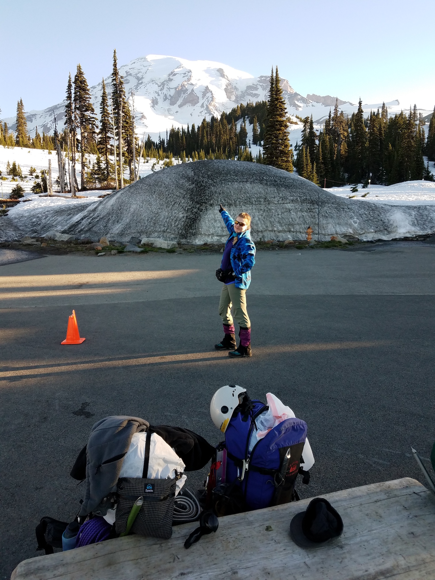
[3]Jenny says “we go there” on Saturday morning.
There was snow all the way down to Paradise, and the summer route with the switchbacks past Panorama Point had not been cleared yet, which meant we had to ascend the steep slope just below the toilet at Panorama Point (which actually exists; I had never seen it before, since I had always taken the High Skyline trail). That was the only steep part, though. After that, we were on the long but relatively gentle Muir snowfield. It took us about 6 hours to get to Camp Muir. At around 11, we heard from our three skier companions who were going to make up the second rope team.
 [4]
[4]Jenny and Vicki on the hike up, still close to Paradise.
 [5]
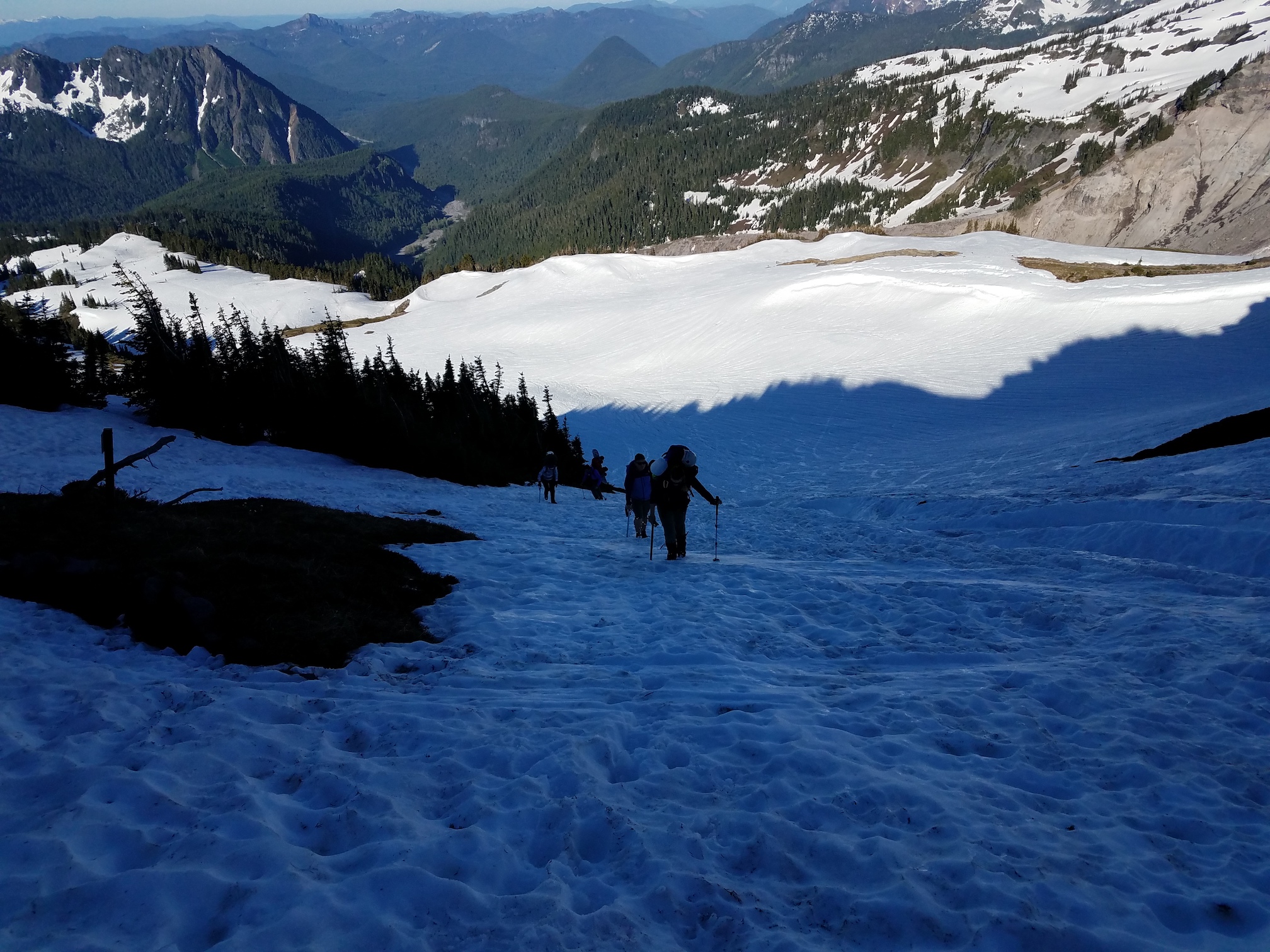
[5]Jenny, Vicki, and some other folks heading up the steep slope to Panorama Point.
 [6]
[6]Jenny and Vicki near Pebble Creek, the beginning of the Muir Snowfield.
 [7]
[7]Heading to basecamp, with a heavy backpack (picture by Jenny).
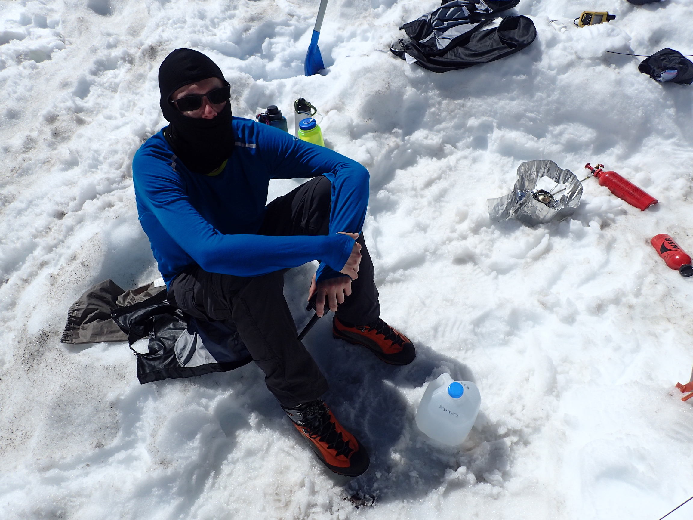
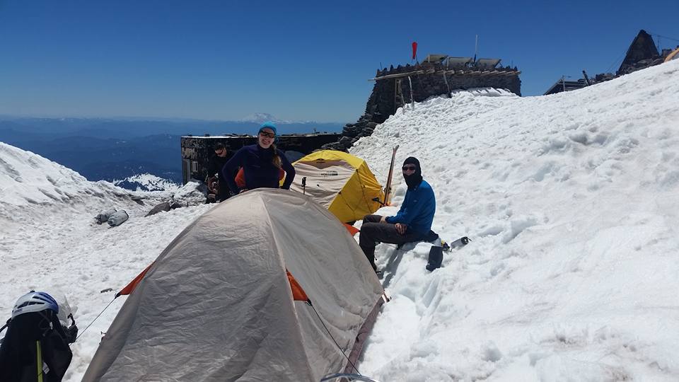
At Camp Muir, we set up our tents and were pretty out of breath, due to the thin air. Vicki hadn’t slept much the night before, and took a nap in her tent under the beating sun. Jenny and I spent about 3 hours melting snow for water, producing about 2 gallons. We also received about another gallon in donations from climbers who were departing Camp Muir. In the middle of this task, we also ate some chicken with rice and teriyaki chicken freeze-dried meals. Then we went to sleep. Or tried to. It was hot and loud. Our earplugs were very useful.
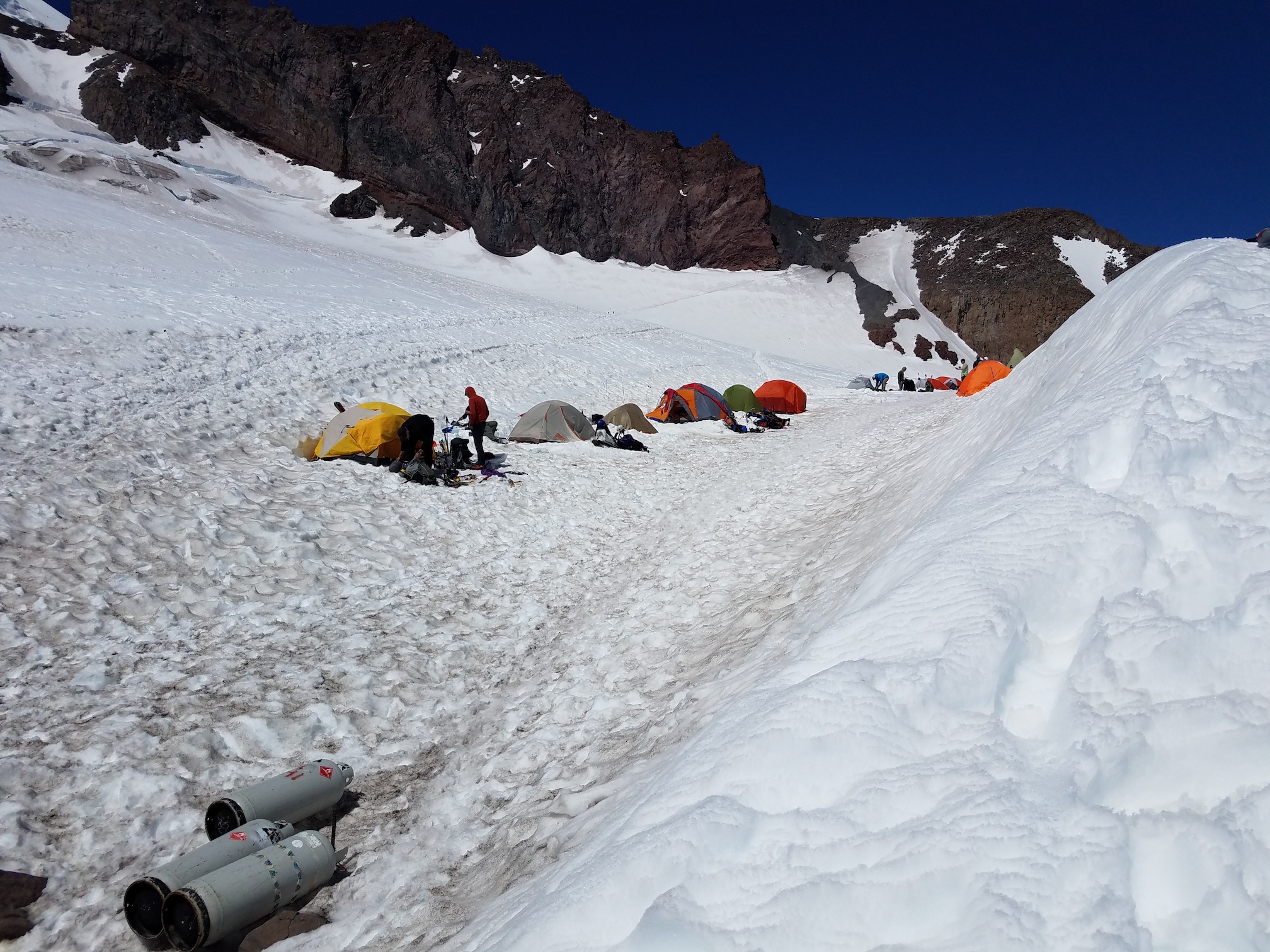 [8]
[8]Line of tents at Camp Muir. Ours are the second and third from the left.
 [9]
[9]Taking a breather, after having set up our tent (picture by Jenny).
 [10]
[10]At Camp Muir, melting snow (picture by Vicki).
We hadn’t heard from the skiers, and we were getting worried that something had happened and that they had turned around, but there wasn’t really anything we could do. Either they’d show up or not. Around 4:30 PM, I believe, I managed to call them on the two-way radio, and around 5 PM, perhaps, they were at our camp and setting up their tents. They weren’t too happy with our plan to get up at 11 PM and start hiking at midnight, so we agreed on an alpine start half an hour later.
Jenny and I got up at 11 PM nonetheless and got our rope and gear ready. I put an alpine butterfly into the middle of my 40-meter rope, two alpine butterflies about 6 or 7 meters to the side from there, and then coiled up the rest of the rope, to be carried by the climbers at both ends. Fortunately, the glacier rope is really light. Vicki, Jenny and I were ready to go at half past midnight, as agreed, but the other team took until a little after 1 AM.
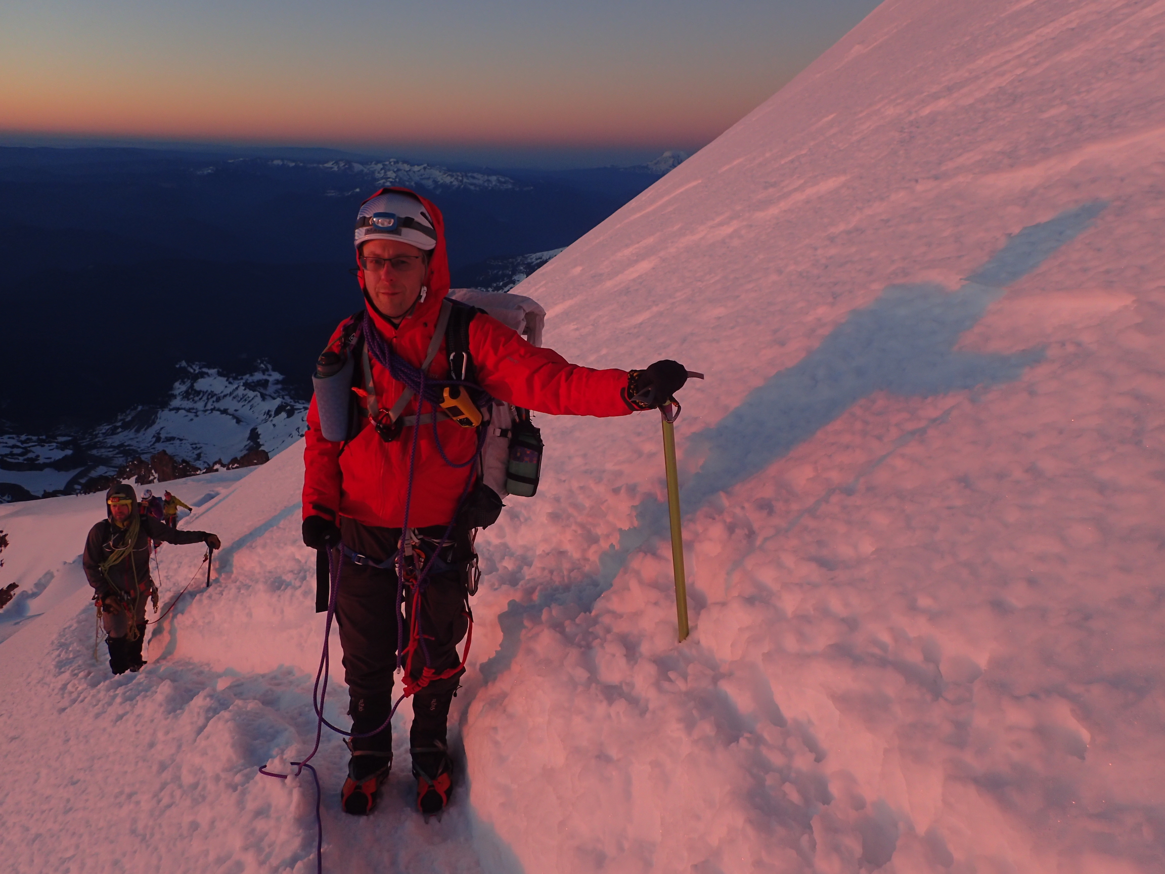
 [11]
[11]Jenny putting on her gaiters and crampons just before midnight.
 [12]
[12]Ready to go at half past midnight!
We followed a chain of headlamps in the distance over the Cowlitz Glacier towards the Cathedral Gap, crossed over onto the Ingraham Glacier, and headed up towards the Ingraham Flats. It was dark, our path only lit by our headlamps, and while we were pretty sure there were no crevasses on the boot path, I still swept my gaze left and right while I was in the lead.
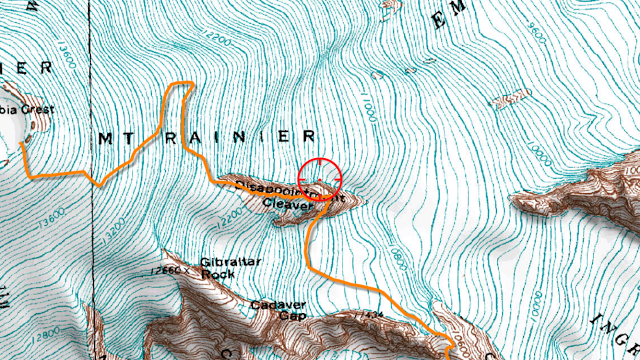
Around 11,300 feet, the path turned to the north and towards the Disappointment Cleaver. Some hand lines were attached, but we didn’t really need them. Ahead of us, there was a 3-person rope team that had used the entire length of a 30-meter rope, with 13 meters or so between climbers. They were relatively slow, and occasionally dislodged little rocks.
About half-way up the cleaver, they sat down to adjust their rope spacing. With their headlamps shining straight into my eyes, I had trouble finding the route for a second, and when we spotted it, we realized I had ascended too far. We swapped leads, since Vicki was right around the correct spots, and she lead most of the way to the summit.
 [13]
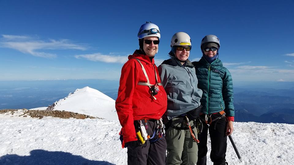
[13]Approximate route, from http://mountrainierclimbing.blogspot.com/2017/06/disappointment-cleaver-6252017.html
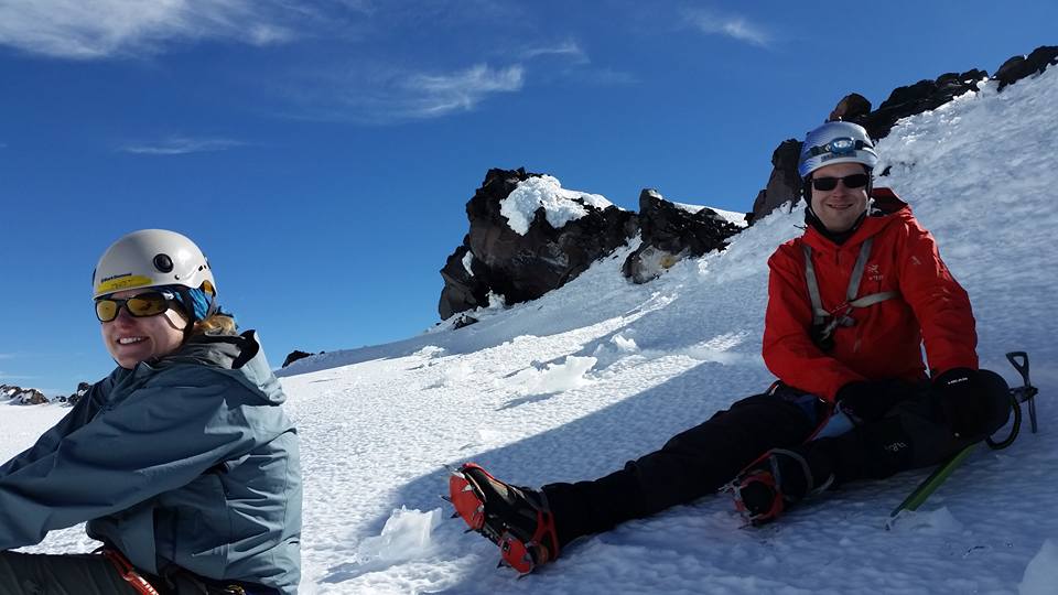
On top of the Disappointment Cleaver, our second rope team told us that, unfortunately, one of the climbers had altitude sickness. We polled every single person if it was okay for Vicki, Jenny and me to continue. I felt a bit bad, but the Disappointment Cleaver route had been pretty simple up to that point, and there were plenty of other climbers around who could help. On the Emmons route, we all would have had to descend, to make sure the second rope team doesn’t get in trouble on the way down (and to make sure we don’t get in trouble by ourselves on the way up).
 [14]
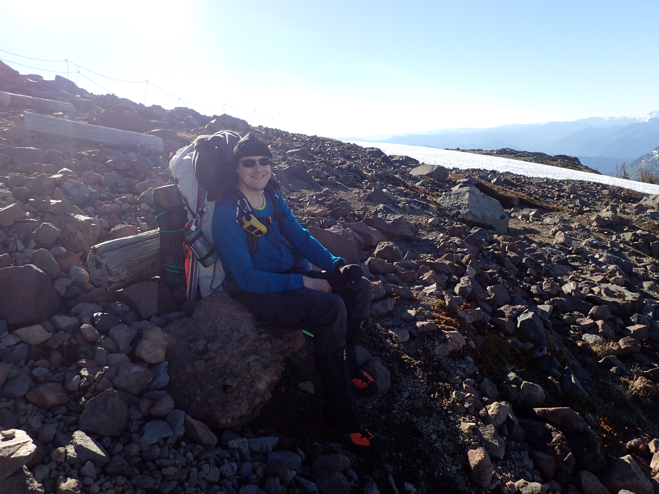
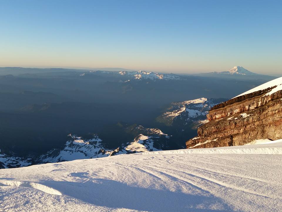
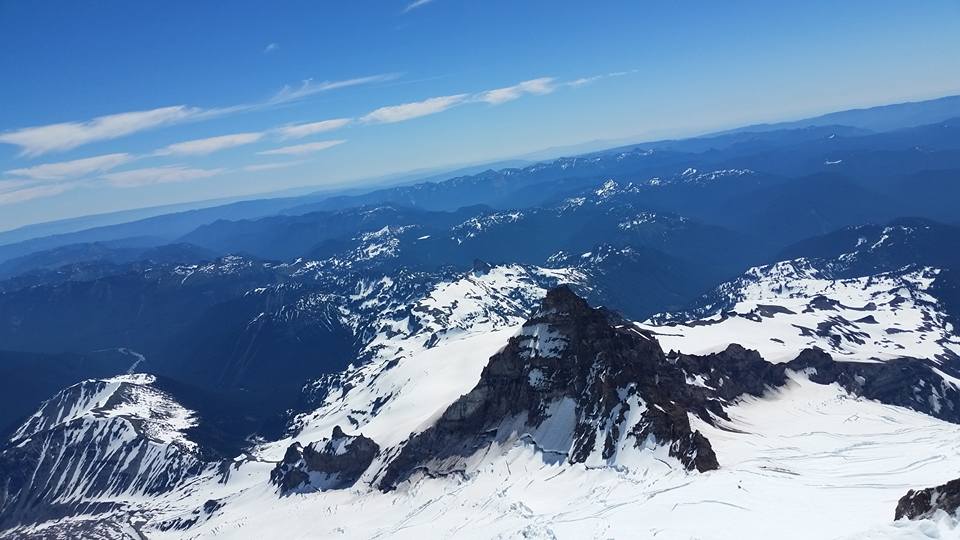
[14]Mount Adams from above the Disappointment Cleaver (picture by Phil).
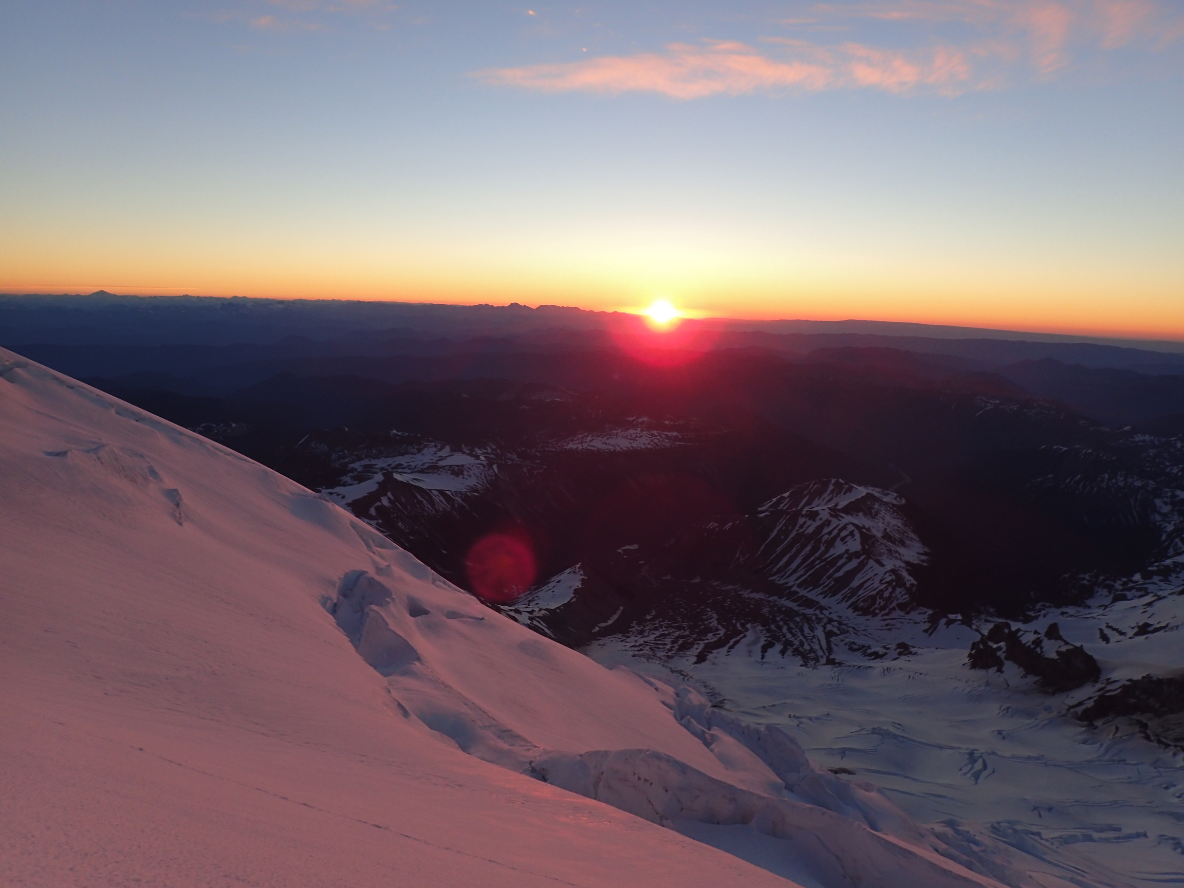
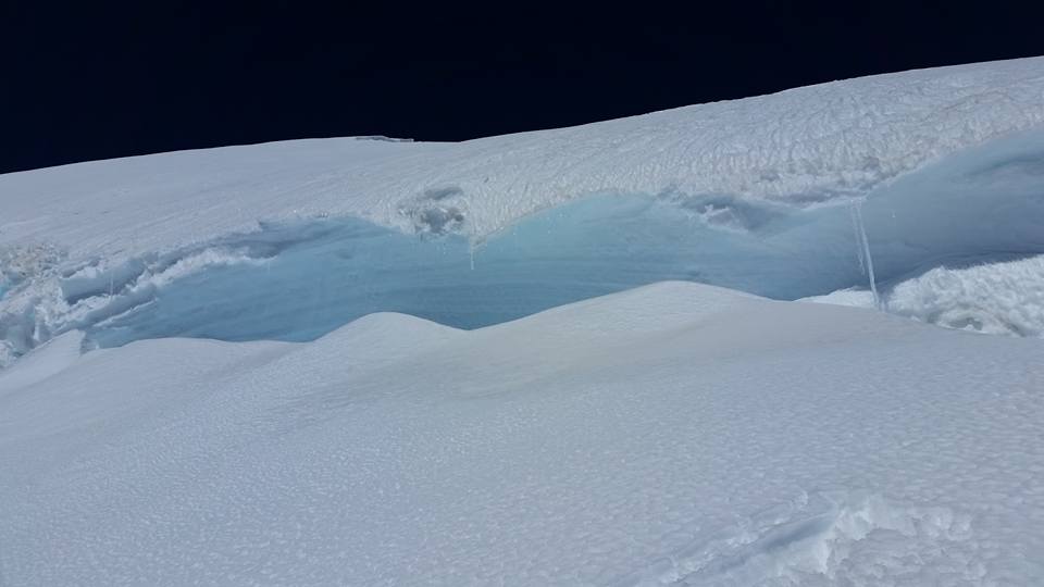
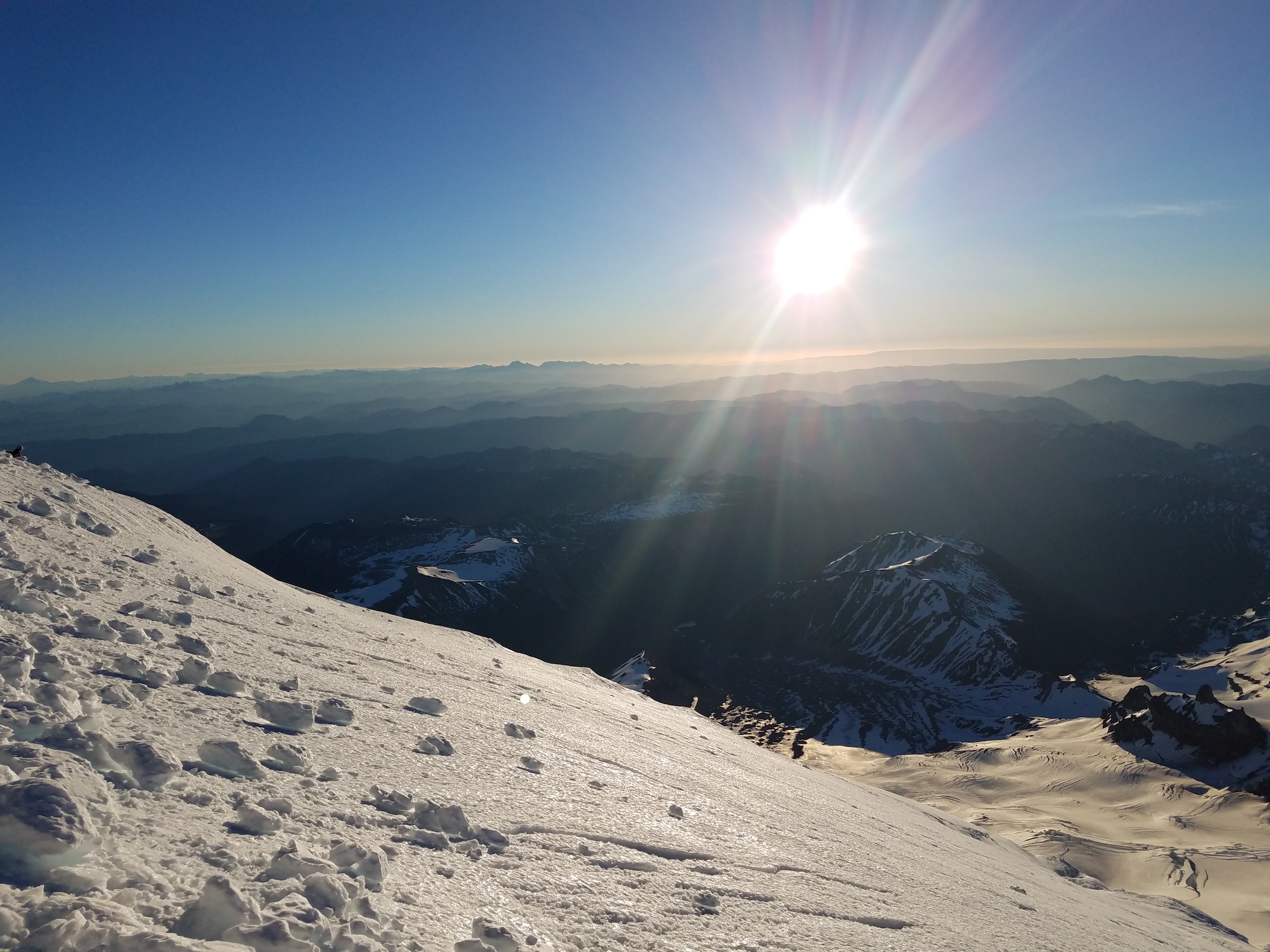
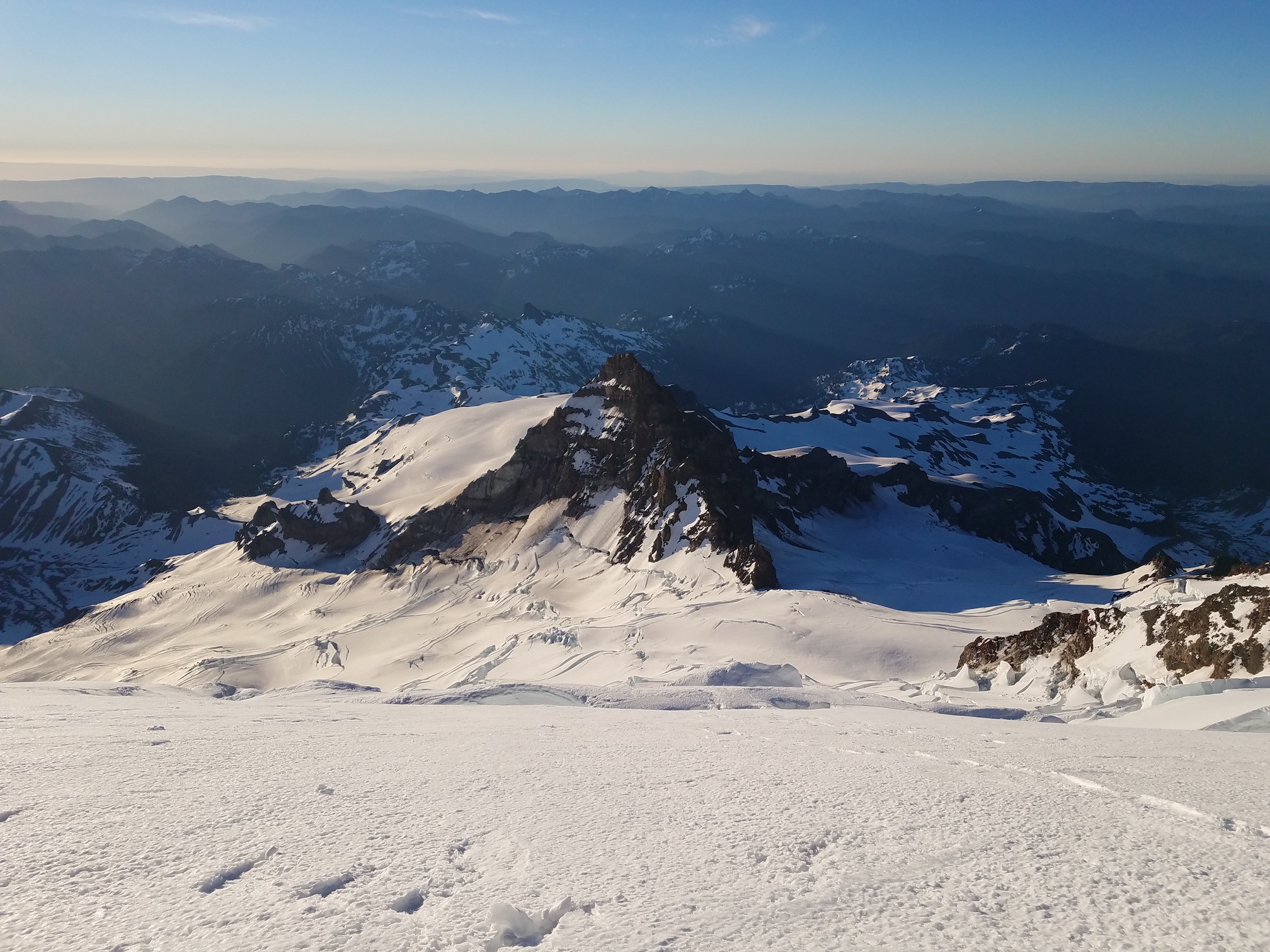
The three of us continued by ourselves, and at around 12,800 feet arrived at what was arguably the most interesting feature of the route. First, we observed the sunrise, painting the mountain in a warm, orange glow. Then we followed a long detour towards the north to avoid a serac, to a point where we could actually see Mount Ruth, and almost see Camp Schurman. On our left, there was the steep serac; on our right, there were crevasses. We carefully but quickly made our way through this fascinating area (not many pictures of this, but here’s a video of our descent [15] through the same stretch).
 [16]
[16]Sunrise at 12,800 feet (picture by Jenny).
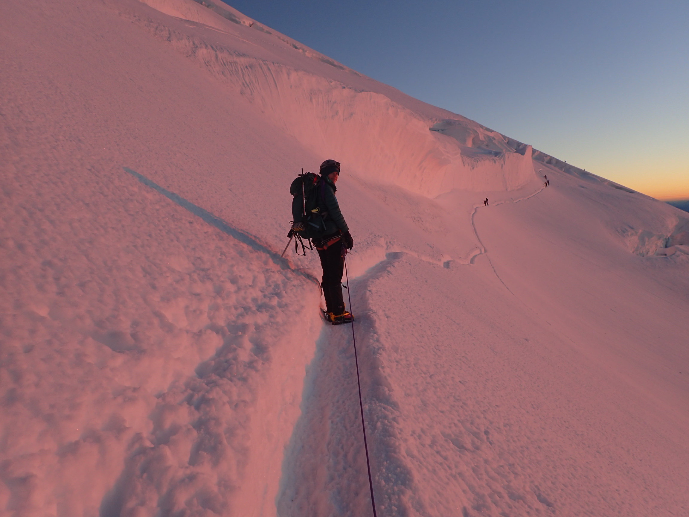 [17]
[17]Vicki, leading our rope team at sunrise (picture by Jenny).
 [18]
[18]I was bringing up the rear at this time. Behind me is another team (picture by Jenny).
 [19]
[19]Icefall above us at about 12,800 feet (picture by Vicki).
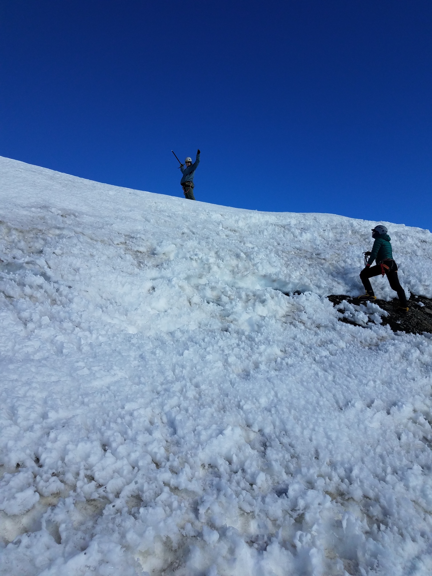
There were pickets and carabiners, but we decided to not use them, since it would slow us down. This was probably a mistake. We either should have clipped into the fixed protection, or we should have unroped. Oh well… we didn’t fall.
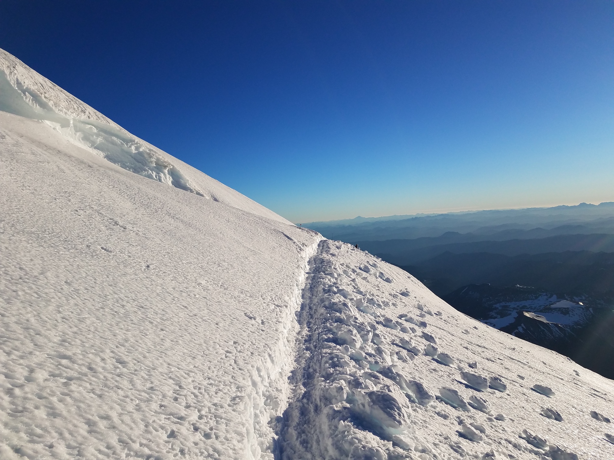
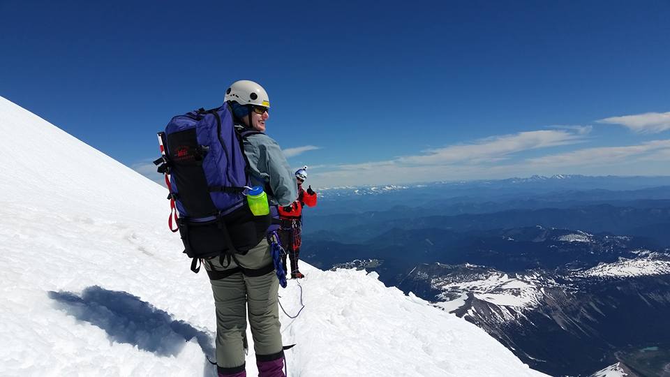
After the detour, we steadily headed up on the mountain to about 13,000 feet, at which point the switchbacks became steeper. A bit higher still, maybe at 13,500 feet, we switched leads again, and I lead our team to the crater rim at 14,000 feet.
 [20]
[20]Jenny and Vicki on a switchback near 13,000 feet.
 [21]
[21]Re-applying sunscreen. Still got a bit burned (picture by Jenny).
 [22]
[22]It was getting pretty hot. I’m pretty sure the dark peak in the foreground on the left is Mount Ruth.
 [23]
[23]The trail behind us above 13,000 feet.
 [24]
[24]Little Tahoma appearing very little from the upper mountain.
 [25]
[25]Little Tahoma from the upper mountain (picture by Vicky).
Ascending Mount Rainier, at about 13,000 feet [26]:
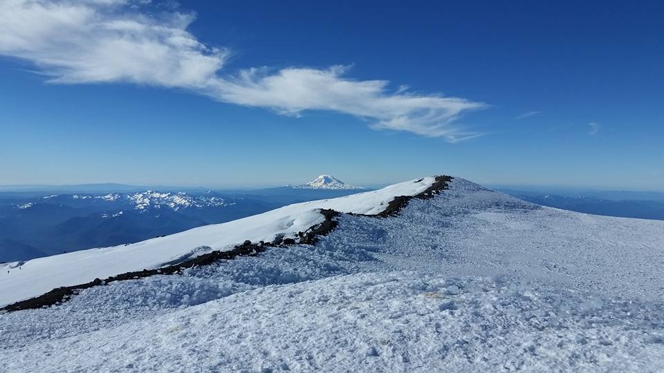
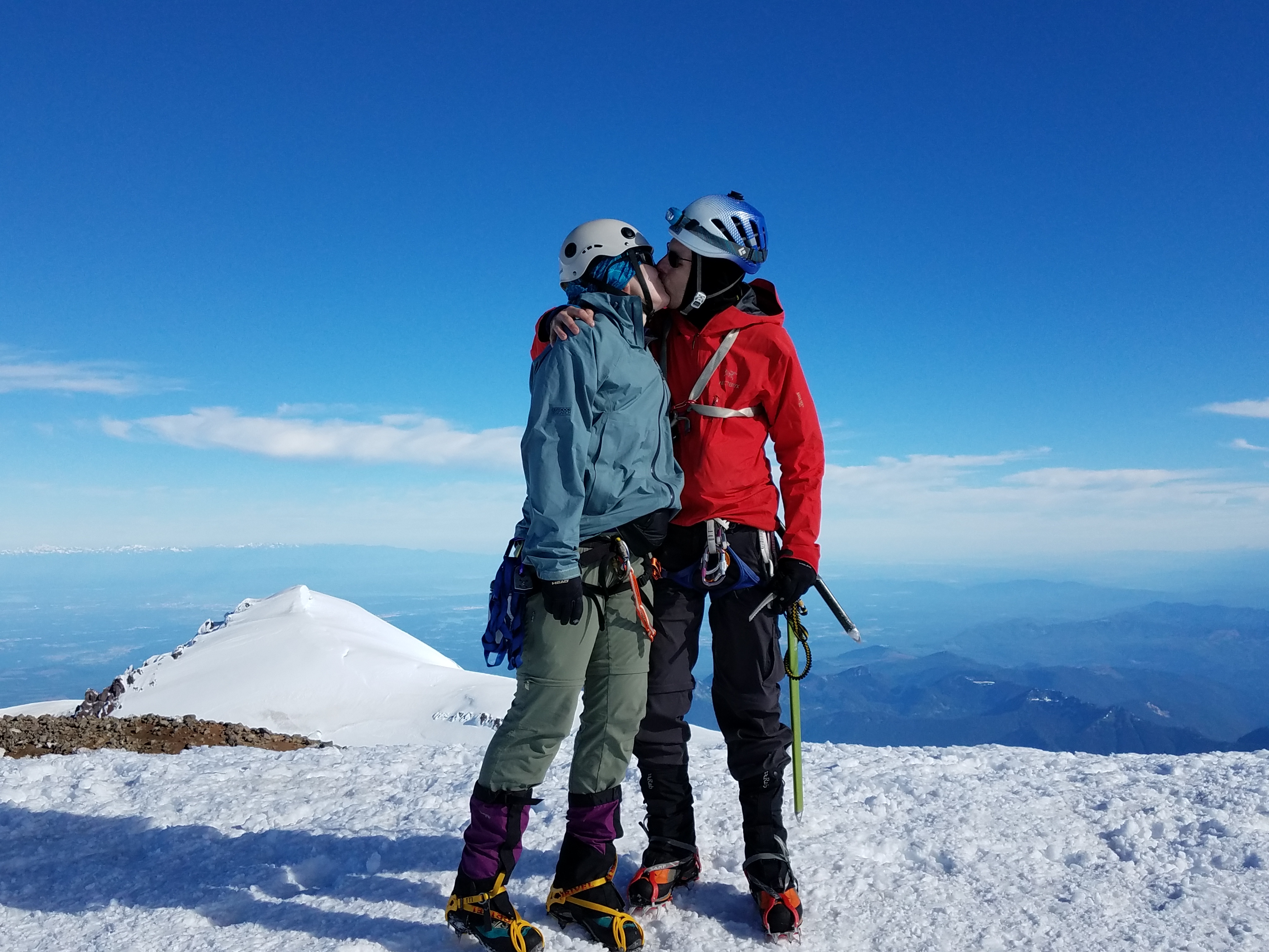
It was a remarkable sight. The crater was much larger than I had thought, the size of several football fields. There was no wind. It was absolutely tranquil. We dropped our packs and unroped, ate and drank a bit, and then headed across the crater to the Columbia Crest, Mount Rainier’s true summit. We reached it at 8:29 AM, after a bit under seven and a half hours of hiking. 9 AM would have been our turn-around time.
 [27]
[27]“I made it!” (Picture by Jenny)
 [28]
[28]Vicki, relieved at the crater (picture by Jenny).
 [29]
[29]Jenny and I shortly after having reached the crater at 14,000 feet (picture by Vicki).
In the crater of Mount Rainier, at 14,000 feet [30]:
The views were incredible. We could see the Olympics and Mount Olympus clearly. Baker and Shuksan were there. Glacier Peak. The Stuart range. Mount Adams. Mount Hood and Mount Jefferson. And Mount St. Helens. Absolutely beautiful.
 [31]
[31]Jenny has reached the Columbia Crest!
 [32]
[32]Mount Adams, as seen from Columbia Crest (picture by Vicki).
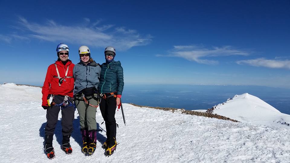 [33]
[33]Jenny, Vicki and I on the summit, with Liberty Cap in the background.
 [34]
[34]Vicki, Jenny and I on the Columbia Crest, Mount Rainier’s summit.
 [35]
[35]On the summit of Mount Rainier.
On the Columbia Crest, the summit of Mount Rainier [36]:
We took some pictures and looked for the summit register, but couldn’t find it. We didn’t care too much. We returned to our packs via the south rim and good views of Mount Adams, ate a bit more, and then roped up for our descent.
 [37]
[37]Jenny and I on the descent, high up on the mountain (picture by Vicki).
I lead the first half down, right to the top of the Disappointment Cleaver. The snow had got quite soft by now, and our going was slow. Before the cleaver, we switched up our positions, and had Jenny lead, with Vicki in the middle, and myself taking up the rear. The cleaver was a bit tricky, but I must have bad memory, because it was much shorter than I had expected. Good! We cleared the cleaver and the icefall called Icebox quickly and headed back towards Ingraham Flats.
While on the cleaver, our second rope team tried to radio us from camp, but we couldn’t respond, the situation was just too difficult to stop and radio. Once we were back on the Ingraham Glacier, we tried to call back, but they must have already descended towards Paradise.
We hopped over the Cathedral Gap again and were back on the Cowlitz Glacier. At this point, I must admit, I ran a bit out of energy. When we had stopped to snack, I had always spent some time with group tasks, such as looking at maps or trying to reach our second rope team, and I hadn’t eaten enough. I was dead-tired by the time we reached Camp Muir again. It had taken us about four hours to get back to camp.
We ate — the best Snickers bar of my life! — and took a brief nap, then packed up our tents. At 3 PM, we started the hike back down. Unfortunately, glissading didn’t quite work on the upper Muir Snowfield, but we hit a few decent glissades farther down. Just a few minutes after 7 PM, we were back at our cars.
 [38]
[38]The hike out, with all our gear in our packs again, was long, but we made it.
Jenny and I ate at the Basecamp Bar and Grill, and reached our home in Seattle at 11 PM. We had been up for 24 hours. 24 amazing hours.
Now, almost three days later, I still haven’t come down the mountain. I’m still high.
Jenny and I will most likely try to go up again later this year, on the Emmons route, if possible. And we’ve already signed up for a three-day climb this next weekend, to Dome Peak, Washington’s 21st highest mountain (according to the Bulger list [39]).
