We’ve been shopping around for a handheld GPS, since many climbs require the ability to retrace our route. Since I have an InReach SE, it made sense to check out the InReach Explorer+, which combines a satellite messenger with topographic maps. We also tried out the GPSMAP 64st. Both devices are by Garmin.
We took both up on our August climb of Mount Rainier. The InReach Explorer+ is nice, since it means we only have to carry one device, instead of a messenger and something with topographic maps. Unfortunately, in terms of map detail and accuracy, it is quite far behind the GPSMAP 64st.
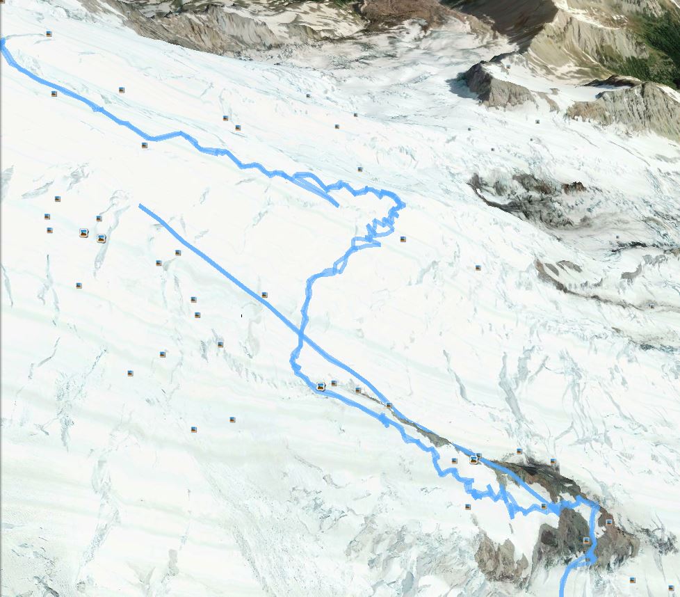
Here are our tracks, from just before the Disappointment Cleaver to somewhere on the Emmons or Winthrop glaciers, as seen in Google Earth. First, the track recorded by the GPSMAP 64st:

Track recorded by GPSMAP 64st
And here is the track recorded by the InReach Explorer+:
Track recorded by InReach Explorer+
You can see that the track on the InReach is much less uniform, and there are a few points that are actually quite far away.
In terms of detail that can be discerned on the display, the InReach also can’t compete with the GPSMAP 64st. Here is the topographic map around Camp Muir, first on the GPSMAP 64st:

Topographic map on GPSMAP 64st
And here is the same map location on the InReach Explorer+:
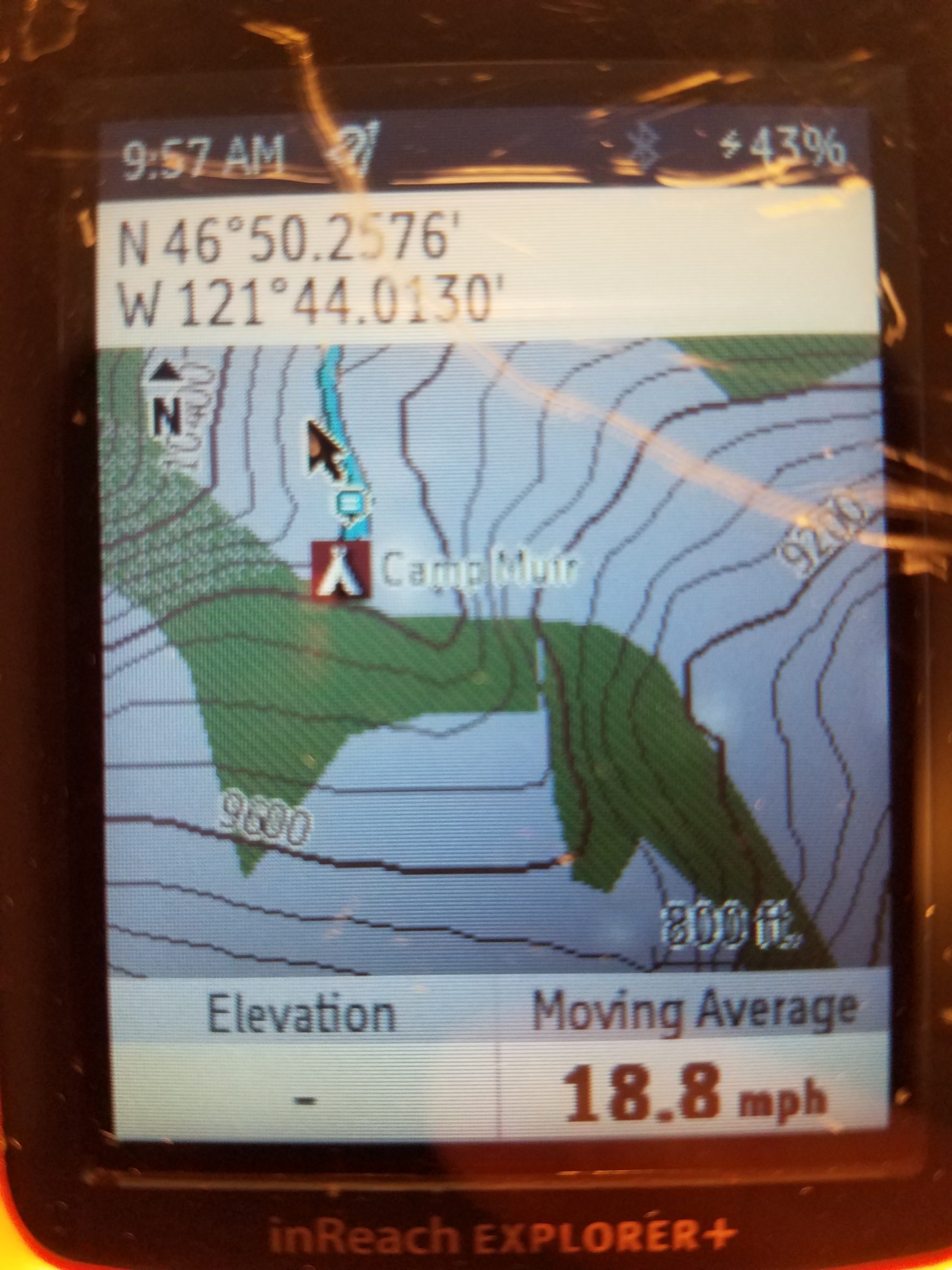
Topographic map on InReach Explorer+
You can’t even see Muir Peak, to the east of the camp!
I think we’ll return the InReach Explorer+ and keep the GPSMAP 64st. We just have to figure out a way to keep the latter from turning on accidentally and draining the battery.

